Design of 24x7 Water Supply System
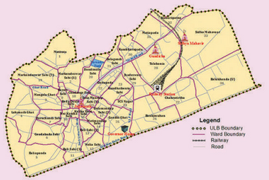
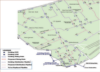
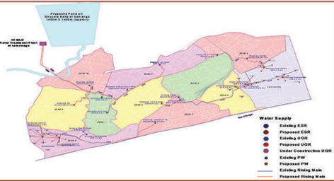
With efficient use of geospatial technology, SPARC undertook the preparation of a Detailed Project Report (DPR) on a 24/7 water supply in one of Odisha’s towns, named Puri. A surface water source was identified for temporary augmentation during the annual Car Festival. The existing water supply network was mapped on a GIS platform along with planning/network extension to uncovered areas. Water demand at various nodes was computed based on projected population and elevation values were assigned to source and demand locations in Geographic Information System.
EPANET water distribution model was run to arrive at pipeline dimensions and installation capacities. A quantity estimate from GIS was used for arriving at the project cost. The DPR was evaluated and approved by the Government of Odisha and the Government of India for funding under Jawaharlal Nehru National Urban Renewal Mission (JNNURM).
The use of geospatial technology was immensely helpful for source identification and water distribution network modeling. The technology also enabled the identification and preservation of aquifers and tidal creeks ensuring citizen well-being and environmental sustainability.
DETAILS
Client: Chief Engineer Public Health, Odisha (through Administrative Staff College of India, Hyderabad)
Project cost: Confidential
Solutions: GIS mapping of existing and proposed water supply system | Planning of 24x7 water supply system