Forestland Information and Decision Support System
As Technology Partners to Odisha Forest Department, we have implemented a robust solution to get precise forestland information for any area of interest. The system is being used as a Decision Support System for forestland governance in the state as per directives of Hon’ble Supreme Court of India.
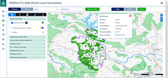
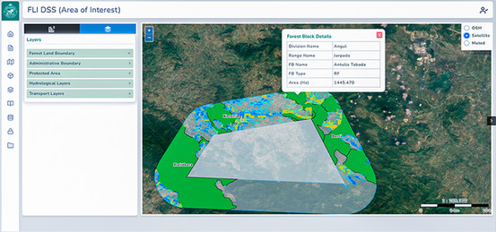
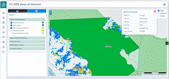
Based on the data infrastructure framework, the system utilizes geospatial database of precisely mapped, geo-referenced forest boundaries integrated with other reference layers, such as: protected areas, migratory paths of wildlife, administrative boundaries, forest working plans, forest cover maps of different time period, topographic maps and revenue cadastral. An analytical dashboard provides region wise details of different kinds of notified, recorded, and deemed forestlands.
The system is being used to prepare forest management plans, afforestation planning, assessment of forest land involvement in various developmental projects, land rights for indigenous people, wildlife protection, etc.
- Geo-referencing of forestlands
- WebGIS-based Forest Land Decision Support System
DETAILS
Client: Forest, Environment and Climate Change Department, Odisha
Project cost: USD 13.5 Million
Solutions: WebGIS based Decision Support System | Remote Sensing studies | GIS mapping and analysis | Geospatial database development | DGPS survey | Mobile application for field survey