Planning and Monitoring of REDD+ Afforestation programs
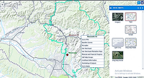
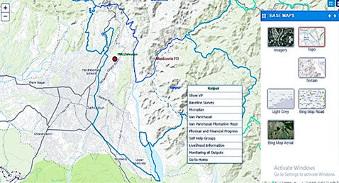
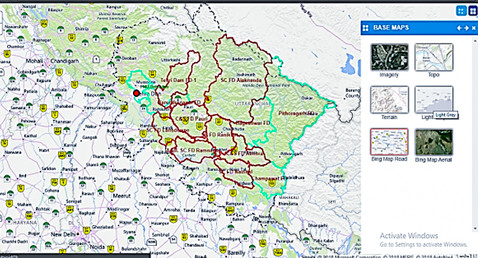
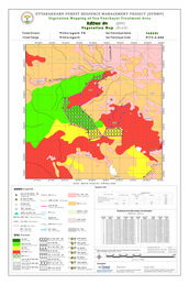
We have successfully implemented innovative Geo-ICT solutions to promote transparency in the restoration of degraded forests across 840 community-managed forest areas in the Himalayan state of Uttarakhand. The project areas were scientifically selected through the use of GIS and satellite remote sensing analysis of forest cover, terrain, and demography. In order to ensure precision in delineating the areas, differential GPS was utilized and micro-plans were prepared using baseline land use and terrain maps, which were generated from high-resolution satellite images and field surveys.
A custom Geo-ICT solution, which integrated GPS, Mobile, and GIS systems, was developed and implemented by us to promote transparency in the eco-restoration process. The system was designed to authenticate reported activities by the communities through time-stamped and geo-tagged images of field interventions that were captured using a mobile app. This approach ensured accountability, transparency, and objective monitoring of the program implementation.
Our solution for degraded forest restoration has revolutionized the eco-restoration process in Uttarakhand, bringing greater transparency and accountability to the project.
DETAILS
Client:
Project cost:
Solutions: Services: GIS and satellite remote sensing analysis of forest cover, terrain, and demography | Customized Geo-ICT solution, integrating GPS, Mobile, and GIS systems