Spatial Monitoring of Polluted Industrial Clusters
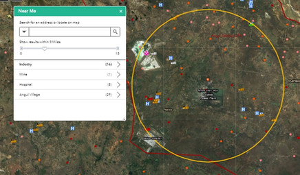
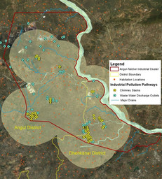
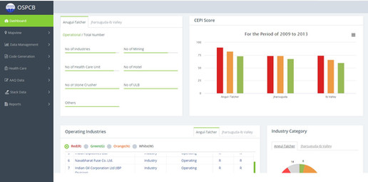
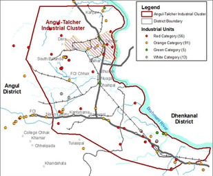
SPARC partnered with the Odisha State Pollution Control Board (OSPCB) to create a WebGIS Decision Support System (DSS) for two critically Polluted Industrial Area (PIA) clusters. Pollution sources were mapped on a spatial platform to identify hotspots, with attributes for air, surface water, groundwater, and soil.
Our system provides locational data on mine reclamation, effluent discharge, comparative analysis of air/water quality, and analysis of pollution impact on agricultural lands and hazardous areas. This helps regulators take timely action and mitigate environmental hazards. The WebGIS system is a powerful tool for decision-making, enabling quick identification of pollution sources and targeted remediation efforts.
- WebGIS-based information dissemination and Decision Support System (DSS)
- Locational data on mining operations, human settlements, environmental quality monitoring stations, medical facilities, etc.
DETAILS
Client: Odisha State Pollution Control Board
Project cost: Confidential
Solutions: GPS survey | Geospatial Database development | WebGIS application development