Technology Based Project Planning for Water Resource Development
With adept use of Geospatial Technology, SPARC assists in efficient and objective planning and formulation of Water Resource Development Projects.
The highlights are:
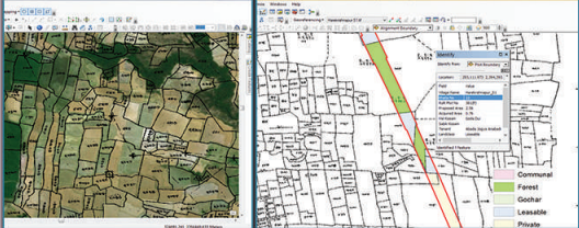
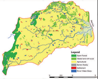
- Use of GIS for site selection and land acquisition planning and processing. Integration of topo data, cadastral maps, RoR data, and satellite images in a GIS environment provides unique visualization for site selection of projects and evaluation of land acquisition options, critically considering parameters of displacement, environmental concerns, engineering interventions, etc.
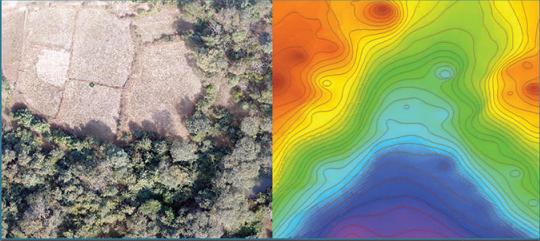
- Adoption of Structure From Motion (SFM) Photogrammetry (using unmanned aerial systems) for generation of ortho-images, digital elevation model (DEM) for large-scale mapping (up to 1:100 scale), contours (up to 20cm vertical interval), longitudinal section and cross-section useful in the planning of irrigation networks.
- Implementation of GIS-based monitoring, reporting, and verification (MRV) system to monitor geographically distributed projects or works adopting remote sensing and GIS.
DETAILS
Client: Confidential
Project cost: Confidential
Solutions: Drone survey | Generation of the point cloud from aerial photos | GIS-based analysis for land use-based run-off computations