Web GIS Based Water Utility Asset Management System
The project focused on conducting a Differential GPS Survey and Geographic Information System (GIS) Mapping of water and wastewater utility assets in Cuttack city. The city, with a population of approximately 600,000 (as per the 2001 census), required efficient management of its water and sanitation services.
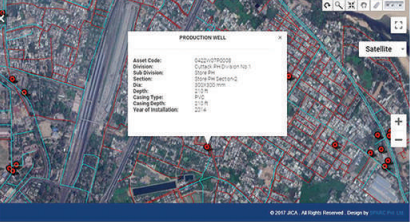
The project activities included collecting and interpreting high-resolution satellite images (HRSI), performing DPGS survey and geo-referencing of the HRSI, preparing a detailed urban base map, integrating existing water and sewage network maps, and conducting DPGS surveys of various water supply and sewerage assets.
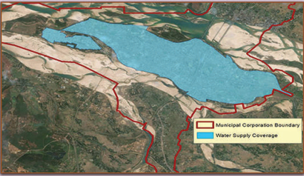
In accordance with the Model National Municipal Asset Valuation Methodology, asset codes were generated in GIS. The administrative jurisdictions of the Municipal Corporation, Wards, Public Health Division, Sub-Division, and Sections were also integrated into the system.
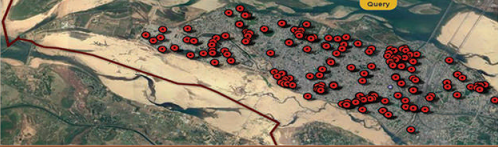
To enhance accessibility, a web GIS-based water and wastewater utility asset management system was developed. This system allows role-based access for departmental users and the public, enabling observation, measurement, planning, and asset valuation.
By utilizing GIS-based mapping of utility assets, the project aims to improve the efficiency, cost-effectiveness, and overall administration of water and sanitation services in Cuttack city.
DETAILS
Client: TEC Consortium
Project cost: Confidential
Solutions: Web GIS-based water utility asset management system | Query and analysis in Web GIS | Asset assessment analysis