All
Forest & Wildlife
ENVIRONMENT & CLIMATE CHANGE
Agriculture
MINING & GEOLOGY
GOVERNANCE
URBAN AREA MANAGEMENT
WATER RESOURCES
UTILITY NETWORKS
INDUSTRIAL ESTABLISHMENTS
DISASTER RISK MANAGEMENT
All

Load More
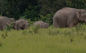
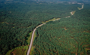
Forest & Wildlife

We're not just about preserving nature - we're also about leveraging technology to make it more efficient and effective.
From offering data-driven forest management to ensuring transparency tech for monitoring forest carbon projects and creating forest land information systems, our team has the know-how to get the job done right.
But we don't stop there. We're also committed to using GIS to measure and track the impact of our conservation efforts. That's why we offer carbon and biodiversity mapping services, allowing us to gain a better understanding of the ecosystems we're working to protect.
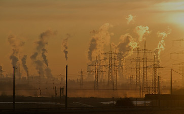
ENVIRONMENT & CLIMATE CHANGE

We understand the importance of monitoring our environment in order to protect it for future generations.
From analyzing GPS data to identify pollution sources to monitoring changes in land use and forest cover using satellite images, we use technology to collect and analyze data that helps us better understand our environment.
We also implement IoT solutions that allow for the automated acquisition of environmental and activity data through location-based sensors and use GIS-based analytics and business intelligence tools to deduce trends, and patterns, and plan mitigation measures.
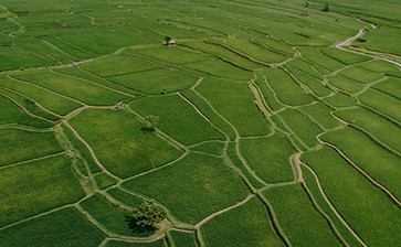
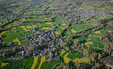
Agriculture
We deploy the latest GIS technology to help farmers manage their farmland with scientific precision, providing them with the tools they need to maximize crop yields and prevent crop loss. Our expertise in agriculture includes developing land-use plans that take into account water availability, soil composition, topography, and agro-climatic zones.
With our crop classification models and cropland monitoring, we're able to make input recommendations that help farmers make the most of their resources. Our guidance on finance, insurance, and market linkage ensures that farmers have the support they need to succeed both pre and post-harvest.
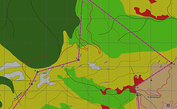
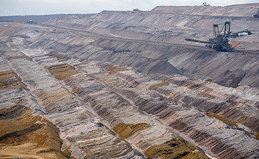
MINING & GEOLOGY
Our solutions in this sector include a geo-referenced Mines Information System, as well as geo-referencing of forest land safety zones. We also offer Environmental Compliance Management Systems to ensure that mines are operating within regulations.
Our Mine Asset Tracking System helps keep track of assets in real time, while our Mineral Production Monitoring System ensures that production levels are optimized. We use satellite data to map land use and land cover and can generate detailed elevation models using UAV-based aerial photogrammetry. In addition, we help mining companies overcome compliance-related deviations through strategic planning and support. Our Mining Tenement Registry System and Mineral Resource Classification (as per UNFC 2009) provide comprehensive management solutions for mining operations.
GOVERNANCE
Our team of experts works closely with government officials to identify geographic disparities and implement effective public schemes. We also provide comprehensive management solutions for social infrastructure, ensuring that citizens have access to critical services like education and healthcare. Some of our other solutions include Public Transport Permit Management, Property Tax Management, City Master Plan, Location-based Monitoring, and Welfare Scheme Monitoring.
We also look into planning for indigenous communities, and their land management, involving them for forest and wildlife management. Besides, we help governments assess and mitigate the risk of natural disasters by developing hazard-risk-vulnerability assessments, early warning systems, and disaster response plans.
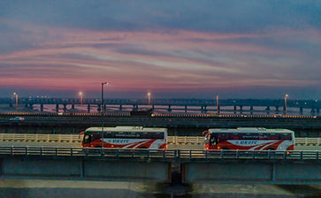
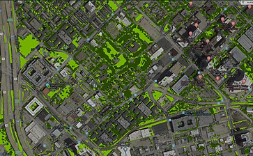
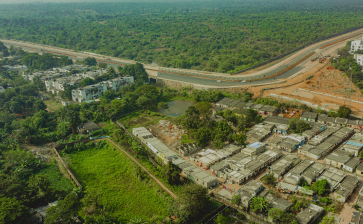
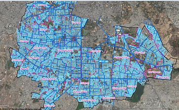
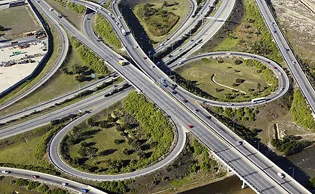
URBAN AREA MANAGEMENT

As a seasoned player in the urban management sector, we have been lending a hand to cities by introducing cutting-edge GIS-based solutions for a variety of purposes such as enhancing revenue, managing assets and utilities, and improving citizen services. We’ve been successful in creating innovative applications to improve citizen participation for city management (crowd-sourcing of inputs).
Our expertise is divided into several key areas, including property tax mapping and monitoring, asset mapping and management, city planning and development, preparation of DPR (Detailed Project Report) for slum area development, smart city solutions, and the generation of detailed maps using drone-based photogrammetry. We also implement utility asset management and GLASS (GIS-based Land and Asset Surveyance System).
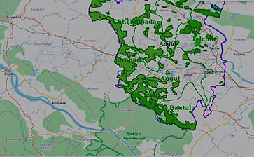
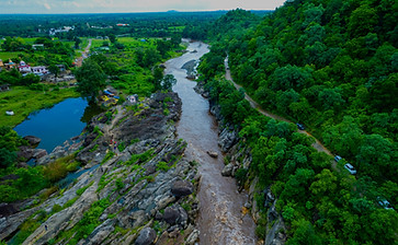
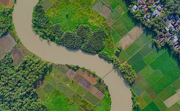
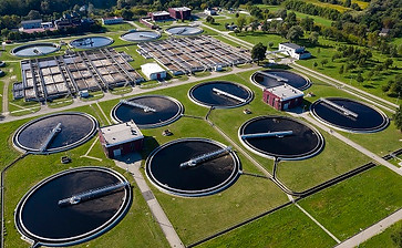
WATER RESOURCES

We are dedicated to creating innovative geospatial solutions that safeguard our precious water resources and ensure a sustainable future for us all. In that aspect, we develop and implement geospatial solutions for integrated water resources development and management. These solutions help preserve vital water bodies, ensuring both environmental sustainability and human well-being.
We even cater to various other areas, such as conducting water balance studies for river basins and watershed approach for integrated water resource development and management. Besides, we’re also into surveying, planning, and designing irrigation systems, implementing flood forecasting systems, and identifying hydropower potential.
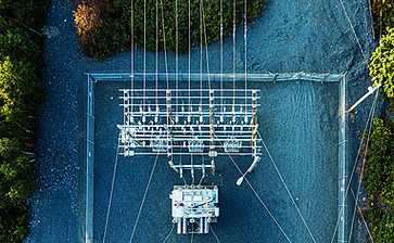
UTILITY NETWORKS
Our geoinformatics team is dedicated to analyzing critical land parameters such as ownership, accessibility, proximity to resources/markets, and environment to facilitate the establishment of industrial enterprises. With our unique solutions and services, we make site selection and land acquisition a seamless and hassle-free process, eliminating uncertainties and complexities that often arise.
Some of our major services include site selection, land acquisition filing and monitoring, forest clearance, land, asset and utility information systems, environmental compliance management systems, planning of industrial townships, and CSR activity monitoring systems.
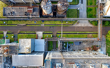
INDUSTRIAL ESTABLISHMENTS

Land acquisition is complicated and often fraught with uncertainty. Our geo informatics team is dedicated to analyzing critical land parameters such as ownership, accessibility, proximity to resources/markets, and environment to facilitate the establishment of industrial enterprises. With our unique solutions and services, we make site selection and land acquisition a seamless and hassle-free process.
DISASTER RISK MANAGEMENT

We also specialize in developing GIS-based decision support systems for managing natural calamities and man-made disasters such as floods, cyclones, and forest fires.
Our services in this area include hazard-risk-vulnerability assessment, early warning system development, disaster resilience plan formulation, disaster response and mitigation plan formulation, and damage assessment systems. We empower decision-makers with the critical information they need to prepare for and respond to crises effectively. From identifying vulnerable areas to developing response plans and assessing damage, our expertise helps communities bounce back stronger and more resilient than ever.