July 12, 2023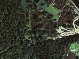
"Geo-referencing of Forests in India: Ensuring Effective Conservation and Management"
Georeferencing of protected forests in India can play a crucial role in ensuring the effective conservation and management of India's biodiversity-rich forests. By providing accurate information on the location, extent, and boundaries of protected areas, it can help define and enforce clear boundaries, reducing the likelihood of encroachment and illegal activities, and monitoring and control the movement of people and vehicles within these areas, preventing unauthorized access and ensuring the safety of wildlife. It can also help monitor changes in forest cover and biodiversity over time, allowing for early detection and management of threats to these areas, and aid in the development of conservation strategies and policies, based on accurate and up-to-date information.
The process of georeferencing forest land is cumbersome process and requires a huge investment by the States & UTs. The Central Government of India has allocated funds from CAMPA to provide assistance to the States & UTs for georeferencing of forests. The CAMPA funds are utilized for compensating the loss of forest land and ecosystem services by raising compensatory afforestation, improving the quality of forests through assisted natural regeneration, enrichment of biodiversity, improvement of wildlife habitat, control of forest fire, forest protection, and soil and water conservation measures. The Compensatory Afforestation Fund (CAF Act), 2016, and Rules, 2018 provide elaborate guidelines and activities for the utilization of the CAMPA Fund. CAMPA also supports the creation of nurseries for the multiplication of quality planting material of locally suitable plant species. The monitoring and evaluation of CAMPA activities are provided in the CAF Act, 2016. The monitoring of CAMPA activities in States/UTs has been carried out through Internal and Third-Party monitoring and the e-Green watch web portal.
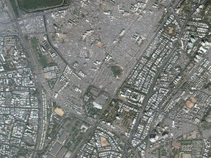
Odisha's forests, which constitute about 39% of the state's geographic area, are bestowed with rich mineral resources and are home to Indigenous Tribal communities. The state has about 61, 204 sq. km. of land recorded as forest land, out of which 36,049 sq. km. is reserved and 25,133 sq. km. is protected forest. However, the boundary of such forest lands has not been properly surveyed and mapped, making them vulnerable to encroachments and misuse. To save forest lands from such vulnerability, the Hon'ble Supreme Court in Lafarge Case (2011) has directed all the States to identify and geo-reference all their forest land records for effective forest conservation.
The Government of Odisha has also developed and notified a Standard Operating Procedure (SOP) for Geo-referencing of Forestlands in 2017 with the joint involvement of the Forest and Revenue Department. The survey and mapping of all forest lands in Odisha have been taken up using Remote Sensing, GIS, and differential GIS technology, following the (SOP) to produce precise geo-referenced and digitized forest boundary maps.
SPARC undertook a DGPS survey of the demarcated notified area (Reserve Forests and Protected Reserve Forests) and carried out need-based reconciliation with revenue land records. Difficult/inaccessible terrain, missing demarcations, and inadequate boundary description posed a challenge. However, GIS technology was used to integrate various decision support information such as working plan maps, satellite images, cadastral maps, forest block maps, etc. which provided unique visualization to decide forest land boundary locations. Precise forest land boundary records-DGPS boundary coordinates and forest boundary maps enriched with thematic references and authenticated by forest divisions were generated for effective forest land governance.