July 12, 2023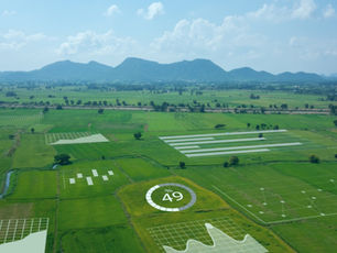
Potential of IoT in Geo-Spatial Sector
The Internet of Things (IoT) has the potential to revolutionize the geospatial sector by enabling the collection and analysis of vast amounts of real-time data from various sources such as sensors, satellites, and mobile devices. By integrating IoT technologies into geospatial systems, organizations can gain insights into the physical world and make informed decisions based on accurate and up-to-date information.
Here are some examples of how IoT can be used in the geospatial sector:
Environmental monitoring: IoT sensors can be used to monitor environmental conditions such as air quality, water quality, and weather patterns. This data can be integrated with geospatial systems to create real-time maps and visualizations that help organizations make informed decisions about resource allocation, disaster response, and land-use planning.
Asset tracking: IoT sensors can be used to track the location and status of assets such as vehicles, equipment, and inventory. This data can be integrated with geospatial systems to provide real-time information about the location and status of assets, helping organizations optimize their operations and improve efficiency.
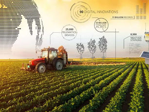
Precision agriculture: IoT sensors can be used to monitor soil moisture levels, crop health, and weather patterns. This data can be integrated with geospatial systems to create precision agriculture maps that help farmers optimize their crop yields and reduce waste.
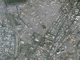
Smart cities: IoT sensors can be used to monitor traffic patterns, air quality, and energy consumption in cities. This data can be integrated with geospatial systems to create real-time maps and visualizations that help city planners optimize traffic flow, reduce congestion, and improve the quality of life for residents.
In conclusion, IoT has the potential to transform the geospatial sector by enabling organizations to collect and analyz
e vast amounts of real-time data from various sources. By integrating IoT technologies into geospatial systems, organizations can gain insights into the physical world and make informed decisions based on accurate and up-to-date information.