5G is the next generation of mobile networks, promising faster speeds, lower latency, and greater capacity. It is expected to revolutionize the way we connect and interact with our devices and the world around us. One area where 5G is expected to have a significant impact is in the field of maps and location intelligence. In this blog post, we will explore the potential impact of 5G on maps and location intelligence.
Improved Navigation
5G networks offer faster speeds and lower latency, which means that location-based applications can be more responsive and accurate. This will improve navigation, as the real-time location data will be more accurate, allowing for more precise route planning. With 5G, location-based services can become more responsive and dynamic, providing users with real-time updates on traffic, weather, and other relevant information.
Enhanced Augmented Reality (AR) Experience
5G is expected to provide the bandwidth and low latency required to support high-quality AR experiences. This means that location-based AR applications will be more responsive and immersive, providing users with more realistic and engaging experiences. AR applications can use location data to provide users with relevant information about their surroundings, such as the names of buildings or the history of a location.
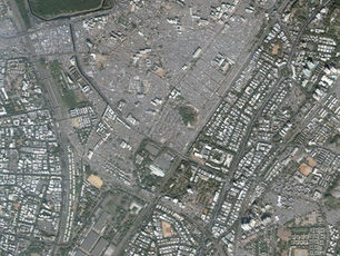
More Accurate Mapping
5G networks can support high-speed data transfer, which means that more data can be captured and processed in real-time. This can improve the accuracy of mapping data, as more data can be collected and analyzed. This will lead to more accurate and up-to-date maps, which can be used for a range of applications, from navigation to urban planning.
Improved Autonomous Vehicle Navigation
Autonomous vehicles rely on accurate location data to navigate safely and efficiently. 5G networks can support the transfer of large amounts of data in real-time, which means that autonomous vehicles can receive real-time updates on their surroundings, including traffic, weather, and other relevant information. This will improve the safety and efficiency of autonomous vehicle navigation, making it possible to have fully autonomous vehicles on our roads.
Better Disaster Response
5G networks can support the transfer of large amounts of data in real-time, which means that location-based applications can be used to improve disaster response. For example, emergency responders can use real-time location data to track the location of people in need of assistance and to plan their response. Additionally, maps can be used to identify areas that are at high risk of natural disasters and to plan evacuation routes.
Conclusion
5G is expected to have a significant impact on maps and location intelligence. It will improve navigation, enhance AR experiences, provide more accurate mapping data, improve autonomous vehicle navigation, and enable better disaster response. As 5G networks continue to be deployed around the world, we can expect to see even more innovative applications of location-based technology.